- Home |
- Why With Us |
- About Us |
- Booking |
- Contact Us |
- Site Map


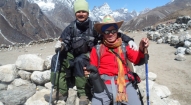
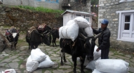
Tsum Valley Trekking
Days from
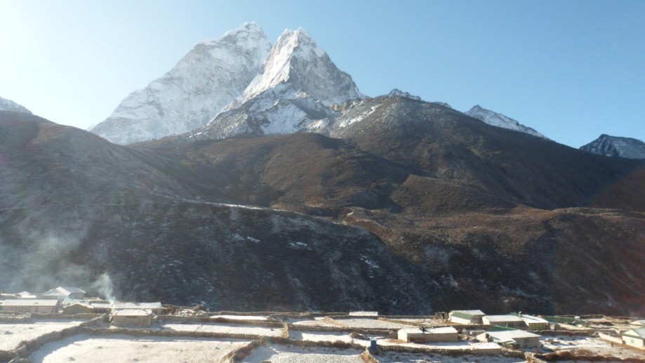
Situated in the Northern part of Nepal’s Gorkha district, the Tsum valley is a sacred Himalayan Pilgrimage site and is often referred as the hidden valley of happiness in the sacred Buddhist texts. Beginning on the main route into the Manaslu Conservation Area the trail to the valley floor winds through a steep –sided gorge and passes along a number of good old slate roof of top mud houses and rugged terrain.
| Max. Elevation : 4460m | Max. Elevation : 4460m |
| Grade : Moderate | Grade : Moderate |
| Best season : Oct - Dec, April - June | Best season : Oct - Dec, April - June |
| Type of trek : FOT (Fully Organized or Camping Trek) | Type of trek : FOT (Fully Organized or Camping Trek) |
Situated in the Northern part of Nepal’s Gorkha district, the Tsum valley is a sacred Himalayan Pilgrimage site and is often referred as the hidden valley of happiness in the sacred Buddhist texts. Beginning on the main route into the Manaslu Conservation Area the trail to the valley floor winds through a steep –sided gorge and passes along a number of good old slate roof of top mud houses and rugged terrain.
Strictly restricted for the foreigners until the year 2008, the Valley is recently opened for trekking and receives proportionally a small number of visitors every year. The word Tsum comes from the Tibetan language “Tsombo” denoting vividness. Flanked by the Buddha Himal (6151m) and Himal Chuli (7893m) to the west, Ganesh Himal (7429m.) to the south and Sringi Himal (7187m) to the north, the Tsum valley remains largely unexplored and is the most popular destination for those who wish to undertake their adventure in Nepal’s one of the most fascinating off the beaten path trail. The valley is bounded by three high passes including – the Ngula Dhooi Hyang (5093m.) to the west and Yamdro pass (5326m.) to the north. The locals of Tsum comprise mainly of people from Tibetan origin which is immediately discernable with their culture, custom and tradition. The Tsum valley has a long history of Buddhism hence it was in this region that the famous Buddhist saint Milarepa was believed to have meditated in the caves of three mountains. Traditionally Tsum valley was a culturally distinct geographical area known as “Tsum Tso Chuksum” meaning “thirteen provinces ruled as a single territory”. The ancient remains of the Tsum Kingdom bear testimony to this fact.
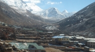
The trails to Tsum Valley are dotted with artistic Chortens and lined with Mani walls made of thousands of stone slabs carved with deities and prayers and follows the magnificent vistas of the Ganesh Himal and other surrounding peaks. The inhabitants of Tsum valley are known as Tsumbas who still practice polyandry system and have unique culture, tradition and dialect of their own. Comprising an area of 1663 sq. km. the valley has a population of about 4000 people who have recently set up Tsum Valley Welfare Committee (www.tsumvalley.org) to protect and promote their distinct culture and identity.
Day 01: Arrive Kathmandu International Airport, (1300m/4264ft) and transfer to hotel.
Day 02: After breakfast we set out for an extensive guided sightseeing tour of Kathmandu valley’s cultural, historical, religious and world heritage sites. During the course, we visit the famous Pashupatinath temple of Lord Shiva situated at the holy bank of River Bagmati where we will also observe the Hindu cremation ritual. We then proceed to the Boudhanath stupa, a major pilgrimage centre for the Buddhist faith which also is the largest of its kind in the world. We then have a short break for lunch followed by a visit to Swoyambhunath stupa also known as the Monkey Temple from where we can have a bird’s eye view of whole of Kathmandu valley. Following this we then proceed for a visit to Kathmandu Durbar Square, the oldest royal palace of Kathmandu and a UNESCO world heritage site. The whole are of Kathmandu Durbar Square is dotted with numerous fascinating Nepalese architect dating back many centuries. The site is also the home of Nepal’s living Goddess – Kumari, where we will also have the opportunity to experience firsthand this unique Nepali tradition. In the evening we will attend the welcome dinner hosted by Makalu Adventure with live Nepalese culture shows.
Day 03: Drive to Gorkha. Trek to Kalikasthan (1060m): After breakfast in Kathmandu, about 5 hour drive from Kathmandu to the historic town of Gorkha, the old capital or kingdom of Nepal, with its old 'durbar', or King's palace and Gorkha Durbar at the top of the hill of Hindu deities, perched high up in the surrounding hillsides and reached by worn stone steps. After organizing the gear and loads with the porters, we head up to our first night's campsite above the Gorkha Fort, stopping en route to visit this well-maintained site, home of the powerful Gorkha royalty until about a century ago. Overnight at tented camp.
Day 04: Kalikasthan to Arkul (570m): After breakfast in the morning; we will head to Arkhul with pass through classic middle hills scenery; rolling, forested hills, snaking rivers with rounded rock strewn on the beaches, local fishermen casting their nets, iridescent rice fields, papaya, lemon and orange trees, water buffalos, thatched huts and local 'bhattis' (Nepali tea-houses). We have a leisurely six to seven hour day for our first real day of trekking; with many locals selling bananas and papayas en route (bring small change). We'll meet many colorful local communities and Hindu local en route and will have time to stop at the many traditional villages along the way. We camp along the beach at a lovely campsite just below the small village of Arkole. Take advantage of a chance for a sun-downer while we're still in the low in altitude!
Day 05: Arkhul to Baluwa (800m): A continuation of yesterday's lovely scenery and another six hour day, we trek though over several swaying suspension bridges spanning the river, past a high waterfall which tumbles to the trail, and back up just a bit to reach our camp at Baluwa in the early afternoon. Tomorrow we have a steep climb ahead of us, and this is the last campsite before the (large) hill. Head down to the river and perch yourselves on the smooth river rocks next to the wonderful swimming hole for a wash after our hot day if you like, and afterwards chilled beers are available from an enterprising little tea-house next to camp. The staff might even pick up some small fish for dinner.
Day 06: Baluwa to Barpak (1915m): Have a big breakfast this morning; we head off early to avoid the afternoon sun for our steep, long climb up to the wonderful village of Barpak, situated perfectly on a green ridge overlooking the misty valley below. It should take us under four hours to get to camp, with several chautaras (rest stops) and the lower village and lively school en route. Barpak is a large village densely populated by Gurung, Ghale (royalty) and Bisokarma, extremely clean, with wide alleys between the houses, grain and vegetables drying outside on the patios, several shops, viewpoints and flowers planted along the decks of these Gurung houses. Many of its men joined the Ghurkha Army, returned to Barpak with new wealth, and have built lovely houses. The villagers often organize 'cultural shows', the proceeds of which go to improving the village, so we might be treated to one in the early evening. We are towered over by Bauddhi Himal, a high, snow-capped peak which makes for wonderful sunrise and sunset photos.
Day 07: Barpark to Laprak (2200m): Another early start and a picturesque climb, with Bauddhi Himal providing a spectacular back-drop to the sprawling, scenic Barpak as we ascend the narrow ridge; we take the small, stone trail to the right of the main trail after an hour or so, and a total of three hours later, we reach the ridge, officially a pass, Gupsi Dada (3000m) which separates Laprak and Barpak, and are rewarded with panoramic mountain views along with herds of sheep grazing on the grassy hillsides from the peak. Bauddhi Himal, Shringi Himal, Ganesh Himal and the Langtang range all span the horizon; a truly breath-taking view. The rhododendrons are blooming brilliantly, in many hues of pink and red, around us, providing great photographs with the snow-peaks in back. Another steep down of a hour or two of trekking brings us down to another large Gurung village, Laprak. The villagers often offer some friendly indoctrination. We camp in the only campsite around, at the school in the upper section of the village, with several tea-houses nearby. Again, we have the afternoon free to explore the village; take a walk down the hill and a look into some of the houses, all with symbolic murals on the mud-brick walls. The villagers are friendly, and there are lots to explore in Laprak’s winding maze of lanes.
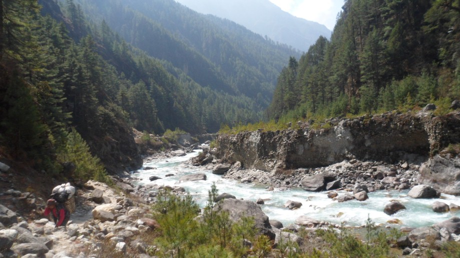
Day 08: Laprak to Khorlabeshi (875m): A classic Nepali trekking day of seven to eight hours, all beautiful. We descend through Laprak's maze of village paths and then to the river. After crossing a very rickety suspension bridge, we climb equally steeply back up, past terraced fields of pink sorghum and rice. We contour around several hillsides on a narrow trail, barely visible at times, up to a small chorten just below the village of Singla. From here, the going is easy, and we enjoy the views of the Manaslu Himal, Kutang Himal and Shringi Himal to the north as we walk down through more terraced fields and papaya trees, through the Gurung village of Khorla, and then down along a narrow, winding trail to Korlebesi on the Buri Gandaki River. Take care as the rocky steps just before the long suspension bridge to Khorlabesi are treacherous. Look out for the local women weaving straw mats in the village. We will probably get a visit in the evening from this village's cultural ambassadors, and perhaps have another show.
Day 09: Khorlabeshi to Jagat (1370m):
A five hour day today, starting with an hour of walking along the river, by tobacco and buckwheat fields, past rocks washed smooth by the river, often climbing up stone steps, to reach the hot springs in the centre of the small, terraced village of Tatopani, where can enjoy for a time to soak our grungy bodies in the gushing hot water, and then perhaps go for a swim in the icy river below, drying off on the wonderful river-side beach. A gentle climb through the woods past with a spectacular waterfalls, across an old, wooden suspension bridge and through a short section of forest path and we reach Dobhan. Above Dobhan, the Bhudi Gandaki River descends in an impressive series of steep rapids. Here, our trail climbs high above the river to descend through the river calms. We cross the river on a long, new suspension bridge and climb high on stone steps before coming into our camp below Jagat, the entrance to the Manaslu Conservation National Park. It is worth wandering around this beautiful, paved village, where proud villagers have recorded how much they contributed to these paving schemes
Day 10: Jagat to Philim (1570m): After descending a long series of stone steps back down to the river from Jagat, we climb on wonderful stone steps along a terraced hill-side to the small hamlet of Saguleri, from where we can see the impressive Shringi Himal 7187 meters high. We pass through the charming, paved village of Sirdibas. We Cross the river again on a long, high suspension bridge at Ghata Khola, the path splits, with the right-hand branch heading off towards the Ganesh Himal. Our route continues upstream, and again we have a steep climb to reach Philim. In the afternoon free to wash at the dharapani (tap) across the path from camp, explore the interesting upper village and gompa, or sit and enjoy the afternoon at camp.
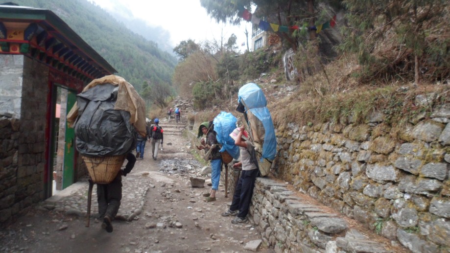
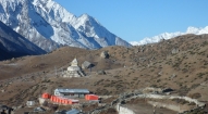
Day 11: Philim to Chumling (6-7hrs). Traverse north out of Philim on the obvious track signposted to the Larkya La, the trail junction going left to Ghap and right to the Tsum Valley. Climb on a well-graded but exposed track through pines, rhododendrons and other trail across the river. The slopes are risk of stone fall from the cliffs above, especially if there are goats grazing. Across the Budi Gandaki is Himalchuli (7893m) above steep cliffs. Walk through a largely intact and peaceful temperate forest into Lokpa (2240m), surrounded by barley fields, where there is a comfortable lodge, toilet and lunch. The hidden valley of Tsum stretches enticingly ahead. Make sure you climb up to Chumling and check out the old gompa, the traditional houses, orchards, clinic and beautiful stone streets. This is Buddhist agriculture, with conical pine needle haystacks among the prayer flags. From here on trails are lined with artistic chortens and mani walls made of thousands of stone slabs carved with deities and prayers.
Day 12: Chumling to Chhokangparo (5-6hrs). Cross the suspension bridge just east of the hotel and traverse through rich farming land of maize and potatoes. The houses are classic Tibetan with barricades of firewood on the roof, but without flat roofs as it rains and snows here. Up the valley to the east are superb views of the Ganesh Himal and its ranges,
Chhokangparo (3010m), stone houses nestled under cliffs without a single iron roof. The valley opens here into spacious fields of barley, maize, buckwheat and potato. Herds of thar often graze the wild cliffs to the north, coming right down to the fields
Day 13: Chhokangparo to Nile (3361m - 5hrs): Head east through small villages and past a local school, climb over a ridge of chortens and past Lamagaon (3202m) through the flat fields, looking across the extensive crops and river to the huge courtyard of the Rachen Gompa (3240m). This nunnery is the female equivalent of the main Kathmandu Kopan Monastery. Climb up and visit Milarepa’s Cave (Piren Phu), where the bringer of Buddhism to Tibet is reputed to have meditated. Cross the Shiar Khola, pass through hamlets of Phurbe (3251m) and Pangdun (3258m) and pass an unusual round stupa before reaching the larger village of Chhule (3347m) through an impressive entrance gate (kani). Head upstream to cross the bridge and climb to Nile (3361m).
Day 14: Nile to Mu Gompa and Chhokangparo (6-7hrs): Early in the morning hike to Mu Gompa (3700m) with valley on the west bank, enjoying sunrise on the narrowing valley walls, yaks being put to pasture and a day with just a light pack. Mu Gompa is through dry Tibetan country, with rows of chortens and widening mountain vistas. This is a large monastery with over 100 monks and an ancient gompa. If time permits you can also visit Dhephyudoma Gompa (4000m) further west on an obvious track. On three sides, there now are superb views of the border with Tibet, with frequently used passes to the east (Ngula Dhojyang or Mailatasachin Pass, 5093m) and west (Thapla Bhanjyang, 5104m) just out of sight. There are extensive seasonal yak pastures in all directions, the Lungdang Glacier to the east and high peaks in all directions. Return down valley through Chhule, collect your rucksack and continue down as far as Phurbe, but stay on the east bank of the Shiar Khola and cross flat boulder-covered plains to Rachen Gompa (3240m), where it is possible to inspect the ancient gompa if you want. The older part of the nunnery is more interesting. Continue south until a bridge crosses to the west bank then descend again to Chhokangparo
Day 15: Chhokangparo to Gumba Lungdang (5-6hrs): Drop below Chhokangparo on the previous trail for about 2hrs, until a small gompa is reached at Gho (2485m). Descend on a narrow trail to the left through the village and drop to a wooden bridge over the Shiar Khola. Cross the bridge to Dhumje (2440m, Tumje) which has a Tibetan herbal medicine clinic and school. Climb very steeply on an indistinct track through pines and rhododendrons until the track starts traversing at a mani wall with prayer flags. The track is exposed and narrow. Finally, in the pine forest, take an uphill trail and make a steep zigzag climb through huge silver pines to reach Gumba Lungdang (3200m), perched on a ridge with small cells for the nuns through the beautiful rhododendrons above. This is small gompa with nuns which has an intense and engrossing puja from 6.00-7.30pm each night. The mountain views in all directions are amazing from this point.
Day 16: Day trip to Ganesh Himal Base Camp (7-8hrs): Cross the Laudang Khola to the west bank on a rickety wooden bridge and climb steeply through pristine pines and rhododendrons on a ridge. There is a hut in a kharka about halfway up, with the track continuing behind it, then up a birch-lined dry creekbed and eventually you emerge into grassy flats behind the lateral moraine of the Toro Gompa glacier. Continue climbing past seasonal yak huts and you will find a track on the moraine wall that gives superb views of the cirque of mountains. It takes about 4hrs to reach the Ganesh Himal Base Camp (4200m). Altitude can make this day difficult for some, but the intact forest wilderness and views make it an outstanding trip.
Day 17: Gumba Lungdang to Lokpa (7-8hrs): Descend from Gumba Lungdang by the upward track, by crossing the Laudang Khola and stay on the south bank of the Shiar Khola. Climb over some very deep gorges and shaky cantilever bridges to picturesque Ripchet (2470m). Take time to look around at this perched fertile valley of barley and buckwheat with evocative chortens in the fields backed by pine forest. Descend on steep stairs to the lone bhatti Ghumlong (2130m) on the river, which you passed through six days ago. Climb again through the pristine temperature forest to Lokpa (2240m).
Day 18: Lokpa to Ghap (7-8hrs): Enter a very narrow gorge with loose tracks, up and down, up and down, cross to the east bank (true left) at one point and then back again to the west bank on a sloping suspension bridge. Enter Nupri through bamboo forests to Deng (1800m), inhabited by Gurungs who practice Buddhism. The river roars below except one place where a rockfall has created a huge dam. Continue in and out of canyons, cross the Serang Khola coming from the north and climb steeply again before finally circling into Ghap (2160m; Tsak). The mani walls here and onwards as far as Bimtang often display intricate quality carvings of various Buddhas in meditation, incised in the hard local stone by a family of carvers from Bihi.
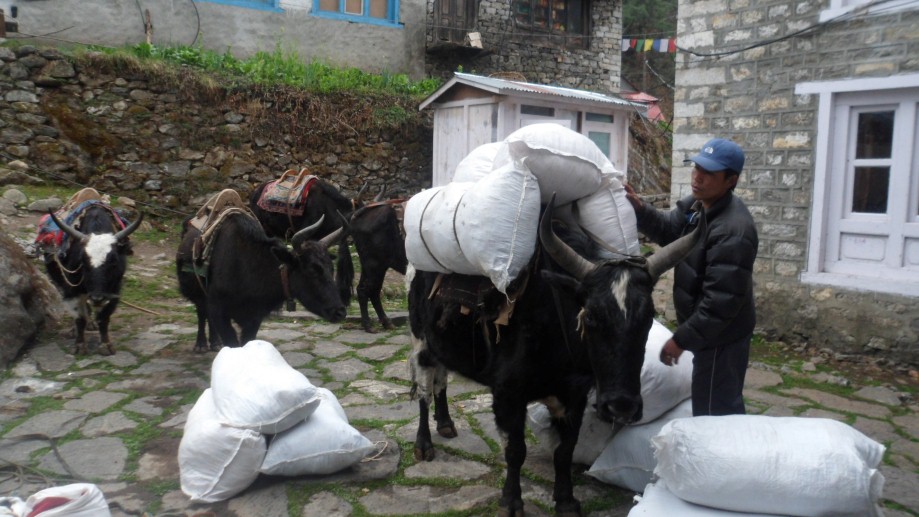
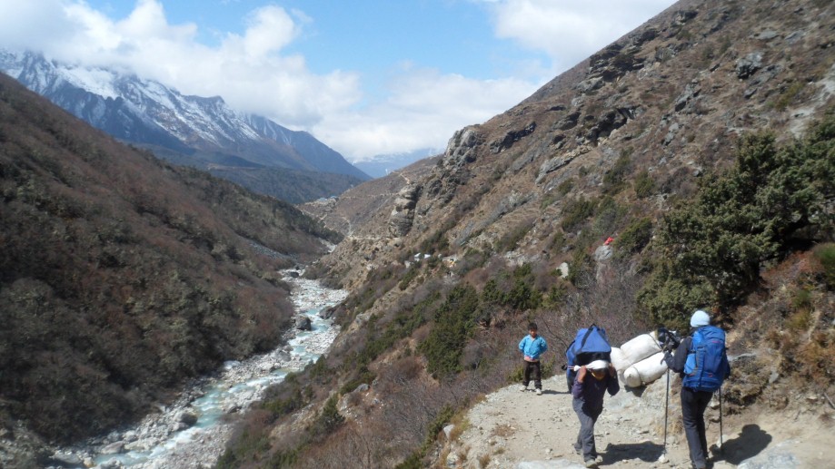
Day 19: Ghap to Lho (3180m): Today is a wonderful trekking day; soon after leaving Ghap, we ascend for an hour through a dense, cool forest, crossing the Bhudi Gandaki River once on a wooden bridge, climb on smooth, stone steps and eventually arrive at Namrung, at 2540 meters at the Tibetan-run lodge. As we gain altitude, we reach alpine territory and are treated to increasingly broad mountain views. Namrung village is the start of Nubri, the region of purely Tibetan inhabitants speaking a dialect of western Tibet. A few hours later, we reach the village of Lihi at 2840 meters, a substantial altitude gain. Lihi houses an old gompa, and is spread along the trail with its billowing fields of barley, guarded by 'bear watches'. We are climb gently now; soon we cross a large stream flowing down from the Lidanda Glaciers and reach the picturesque Tibetan village of Sho at 3000m, where we stop for lunch. After an hour we reach at Lho, where we are treated to breath-taking views of Manaslu itself. We set up camp in Lho, Sunset and sunrise from the campsite are wonderful, and the small Gompa.
Day 20: Lho to Sama Gaon (3525m): Walking through the upper reaches of Lho, with the snowy peaks of Manaslu ahead of us in the distance, we pass the new gompa and then ascend through light forests next to a small river to reach the high, idyllic Tibetan settlement of Shayla, where the villagers are often out in the fields. There are amazing mountain panoramas from here. Another few hours of trekking through classic alpine scenery leads us past Tibet grazing settlements, the trail to Pung Gyan Gompa off to the left, and eventually past checkered fields of barley and potato to Sama Gaon. Sama The people settled here from Tibet over 500 years ago. The Tibetan villages in this region of Manalsu have distinctive entrance gates (manes), and they maintain an active trade with their co-religionists in Tibet over several high passes nearby. If the weather is good, you will see the village women weaving wool from Tibet into gowns - which are then traded back to Tibet. Take the afternoon to hike up to the old gompa settlement above town, and to wander the streets of the fascinating Sama Gaoun village.
Day 21: (Samagaon to Samdo 3850m): Another day of incredible mountain views, past craggy woods of Himalayan Birch, during the walk up to Samdo, an easy three hours away. En route we pas the long Mani walls at Kermo Kharka, after which we spot the entrance chorten of Samdo high on a bluff. We descend back to the Bhudi Gandaki and cross a small bridge before another short climb to the 'kane' entrance of Samdo. There is a small home gompa in a house mid-village which we can visit during our last village, a puja being held by several of the reincarnated lamas living in the Samdo. We're at the high and the wind can be chilling in the evenings, so tuck into the little tea-house next door to our campsite for a cup of salt-butter tea to warm ourselves up.
Day 22: Acclimatization in Samdo. Another rest and acclimatization day in this wonderful spot below Manaslu, which towers above us. We recommend a hike up the valley directly in back of Samdo, heading towards one of their passes to Tibet, for amazing mountain panoramas. En route, we'll pass many lovely, slated herding settlements. The prayer flags strung up on a distant hill, sending messages out into the Himalaya make a good stopping point before returning to lively Samdo.
Day 23: Samdo to Dharamshala (Larkya Phedi) 4460m: We leave Samdo on the old trade route towards Tibet, cross a bridge, and climb through the ruins of Larkya bazaar, one of the trade markets that flourished years back. After about three hours of climbing past glaciers, with increasingly awe-inspiring panoramas, we come to the campsite at Dharamsala, the high camp for the Larkya La pass, where we have lunch and gaze out at the views. You'll really feel the altitude and the cold here, so enjoy a more leisurely afternoon and keep warm. We'll have an early dinner in preparation for our pass crossing tomorrow
Day 24: Dharamshala / Cross Larkya La (4930m) to Bhimtang 3590m. After a short climb above the campsite, we reach the ablation valley on the North side of the Larkya Glaciers where we have views of Cho Danda and then of Larkya-La. We continue across the moraines of the glacier, often through the snow, making a gradual ascent which becomes steeper only in the last section to the pass, which should take us about four hours to crest. The views from the top of the pass are wonderful; a mountain panorama of Himlung Himal, Cheo Himal, Kangguru and the huge Annapurna II, equally stunning from both sides. After hanging our Tibetan prayer flags, get ready for a steep, often slippery drop to a trail following the glacial moraine. We'll lunch below the pass on smooth rocks before continuing the descent, still three hours to go to our campsite. A boulder-strewn descent brings us, finally, to Bhimtang. It's all worthwhile now.
Day 25: Bhimtang to Dharapani (1860m): A chilly but beautiful morning, as the sun hits the peaks around us long before the campsite. After leaving the grazing fields of Bhimtang, we cross a boulder-strewn river and head down through open forests of brilliantly blooming rhododendron, past the Kharka below Bhimtang. We'll lunch at a small tea-house, and then continue along the rocky river-bed and sliding hill-sides to several small, green villages, a sign that we've reached lower altitudes. Eventually, after a somewhat long but very scenic day, we reach the large village of Tilje village which are a mix of Manangis (of Tibetan descent) and Chettris (Hindus), so have a unique architecture and culture, and eat mix foods - Dal Bhat, buckwheat dhiro, tsampa and Tibetan salt- tea. Overnight in Dharapani.
Day 26: Dharapani – Jagat (1314m, 6hrs). Today the trail runs gently downstream of the river passing the village of Chamje and Himal pani. Waterfalls are everywhere, and the vegetation becomes a mixture between the lush greenness and the woodlands of a higher, mountain altitude.We will have overnight stay at Jagat.
Day 27: Jagat - Bhulbhule. We climb through terraced fields to the Karche La, and can see ahead a green and heavily forested valley, dropping down to the distant Marsyandi River. At thonje village is our final restricted area checkpost. Here we cross the Marsyandi River and join the main Annapurna Circuit, and the hoards of trekkers
Day 28: Drive back to Kathmandu from Bulbule.
Day 29: After breakfast we will set out for a sightseeing tour of Bhaktapur and Patan and return to our hotel at late afternoon.
Day 30: Transfer from hotel to airport for final departure

- All ground transfer by private vehicles as per our itinerary
- Fine hotel –Thamel Eco Resort in Kathmandu (twin sharing including b/f and taxes)
- Welcome dinner with live Nepalese cultural program hosted by Makalu Adventure
- Guided sightseeing around Kathmandu world heritage sites including all entrance fees
- All domestic airfares (wherever applicable and stated on the itinerary)
- Organized camping trek arrangements including all high quality German Salewa / UK Super Quasar camping equipment such as two men tent, kitchen tent, dining tent, toilet tent, tables, chairs, mattresses, hot water bags, pillows, inner sheets etc.
- Everyday three times hot meals while on trekking prepared by our professional kitchen crew.
- National park, conservation area permit and fees
- Guide, porters, their daily wages, insurances with all necessary lodging / fooding arrangements.
- Administration service during rescue and evacuation (if required)
- Down jacket, sleeping bags, Trekking kit bag/duffel bag, trekking map and trekking Poles
- A comprehensive medical kit
- All government and local taxes
- Nepal visa fee.
- Airport taxes.
- International airfare to and from Kathmandu.
- Excess baggage charges.
- Lunch and evening meals in Kathmandu.
- Extra night accommodation.
- Travel and rescue insurance.
- Personal expenses (phone calls, laundry, bar bills, battery recharge, extra porters, bottle or boiled water, showers etc).
- Rescue and evacuation if required.
- Tips and gratitude