- Home |
- Why With Us |
- About Us |
- Booking |
- Contact Us |
- Site Map


Mt. Chulu West
Days from
The Chulu group comprises of four peaks: two in the east and two in the west. Chulu West may also be called Chulu Central. There is no technical difficulty in ascending this peak but progress can be slow as the slopes are vulnerable to avalanches in certain conditions requiring some fixed ropes above the base camp.
| Elevation : 6,419m | Range/Region : Manang Himal/Gandaki |
| Latitude : 28o44'24" | Longitude : 84o01'12" |
| Royalty Group : B | Trip duration : 19 days |
| Trip Grade : PD+ | Starts : Bulbhule/Jagat |
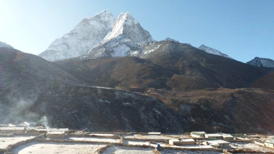
Of the two Chulus (East and West), Chulu West is the higher peak. It was first ascended in 1952 by a Japanese Expedition. It is generally regarded that The Base Camp of this peak is situated in a small valley north of Manang, off the main trail to the Thorang La. There is a controversy regarding the name and location of the Chulu peaks. There are several peaks close by and are also a part of Chulu massif but are not indicated in the map. Thus it is difficult to differentiate between the two Chulus. However, the Chulu group comprises of four peaks: two in the east and two in the west. Chulu West may also be called Chulu Central. There is no technical difficulty in ascending this peak but progress can be slow as the slopes are vulnerable to avalanches in certain conditions. Above base camp some steep loose rock requires some fixing of ropes.
Day 01: Arrive Kathmandu International Airport- T I A (1300m) and transfer to hotel.
Day 02: After breakfast we set out for an extensive guided sightseeing tour of Kathmandu valleys cultural, historical, religious (world heritage) sites. During the course, we visit the famous Pashupatinath temple of Lord Shiva situated at the holy bank of River Bagmati where we will also observe the Hindu cremation ritual. We then proceed to the Boudhanath stupa, a major pilgrimage centre for the Buddhist faith which also is the largest of its kind in the world. We then have a short break for lunch followed by a visit to Swoyambhunath stupa also known as the Monkey Temple from where we can have a bird’s eye view of whole of Kathmandu valley. Following this we then proceed for a visit to Kathmandu Durbar Square, the oldest royal palace of Kathmandu and a UNESCO world heritage site. The whole area of Kathmandu Durbar Square is dotted with numerous fascinating Nepalese architect dating back many centuries. The site is also the home to Nepal’s living Goddess – Kumari, where we will also have the opportunity to experience firsthand this unique Nepali tradition. In the evening we will attend the welcome dinner hosted by Makalu Adventure with live Nepalese culture shows.
Day 03: Drive from Kathmandu to Besisahar (760m) 6 hrs :
We drive along the Kathmandu-Pokhara highway to Dumre and then follow the narrow and paved road by the Marsyangdi River to Besi Sahar . Beshishahar is the district headquarters of Lamjung district and offers scenic views of the surrounding Himalayas. Overnight at lodge or camp.
Day 04: Trek from Beshishahar to Bahundanda (1305m) 6 hrs:
The first part of the trekking passes thorough flat level along the bank of the Marshyangdi River. Along the way we can enjoy the sceneries and the local culture of Gurung people. After lunch, the trail goes steeply upwards to Bahundanda which takes about 2 hours with prominent views of the snow capped Western Nepal Himalayas.
Day 05: Trek from Bahundanda to Chamje (1410m) 6 hrs:
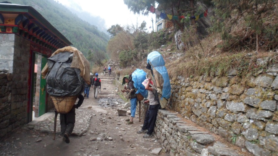
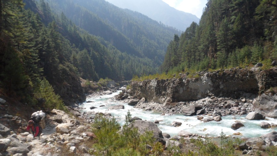
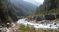
A steep trail descends for early half an hour and then follows flat path through rice terraces, before crossing a stream at the bottom of a small waterfall then it climbs again high above the river before reaching the village of Lali Gaon. Ahead, the Marsyangdi valley forms a steep V-shape, and we follow the winding mountain path down through Syange (1100m.) where there is a beautiful waterfall above it and along the river for some distance. The trail then climbs steeply and the path is cut into the sheer cliff-face some 200-300m above the riverbed. Eventually we will descend to the stone village of Jagat (1330m) situated on a shelf which juts into the precipitous Marsyangdi valley. Now the trail begins to observe small ups and down to Chamje through the forests.
Day 06: Trek from Chamje (1410m.) to Dharapani (1960m) 6 hrs:
The first part of the trail descends to the river and after crossing a suspension bridge, we begin a climb to Sattale (1550m.) on a path so steep that it seems one slip would send us hurtling down into the valley. We continue on an undulating path above the river, and at one point, where a tributary flows in from the opposite bank, the main river becomes covered with huge boulders that hide the water. Climbing the zigzag path to the top of the hill, we see the level, plain of Tal (1700m). Though it is enclosed by cliffs, the level area looks reassuring after the harrowing mountain paths just traveled on. We descend to a grassy riverbank which leads to Tal with its hotels and teahouses. Beyond Tal, the valley narrows and the path becomes high and winding, and in several areas hewn from the rock itself. Beyond the small village of Karte (1900m), there is a bit more cliff-walking before the path drops again to the river. We cross a suspension bridge, and climb the short distance to the stone Mani marking the entrance to Dharapani (1960m).
Day 07: Trek from Dharapani to Chame (2675m) 6 hrs:
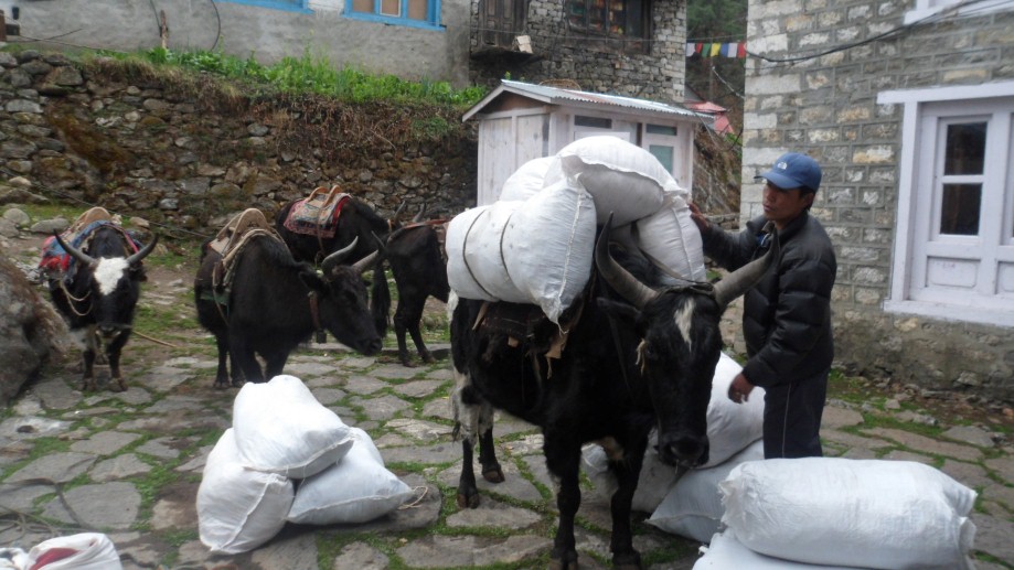
As we cut through a narrow field from the village, the Dudh Khola, which originates from the south face of Manaslu. The Marsyangdi River then veers to the left, and as Annapurna II becomes visible ahead; we arrive at Bagarchhap, a Bhote village with prayer flags fluttering in the breeze around Buddhist monastery. Continuing to climb through forests of pine and oak, we pass through Danaque (2210m.). There comes a small wooden bridge which takes us to follow steep ascent path up to Timang village. It lies at the bottom of Lamajung Himal. The trail goes through flat level until we reach Chame where there are government offices, shops, and hotels. Chame is the district headquarters for the Manang district.
Day 08: Trek from Chame to Pisang (3100m) 6 hrs:
With Lamjung Himal (6893m) dazzling in the morning sun, we set off for Pisang. The mountain disappears as we climb the path up the valley, passing a huge apple orchard. We continue through a fir and pine forest, climbing to a high, rocky area as the opposite bank becomes an impassable cliff. From this point the valley becomes extremely steep-sided as we follow the path to Bhratang (2950m). In the past this was the military station for troops who fought against the Khampa tribal rebels, but the dilapidated buildings are all that remain of that era today. A short climb from the village brings us to a rock-strewn area where we cross a wooden bridge and follow a high, winding path, before crossing back to the right bank again. We now trek through a pine forest and as the forest ends, the valley changes from a V-shape to a gentle U-shape, opening up a wonderful vista. We can see the east peak of Annapurna II as well as Pisang Peak (6091m.) to the north-east. Continuing on, we come to a long Mani wall by a bridge and the lower village of Pisang.
Day 09: Trek from Pisang to Manang (3440m) 6 hrs:
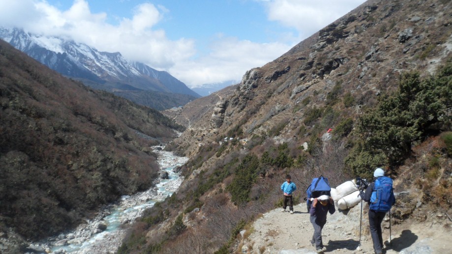
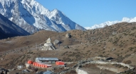
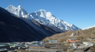
Beyond Pisang, the trail climbs a steep ridge which affords good views of the Manang valley and Tilicho peak (7145m). Descending past Manang's airstrip at Humde (3320m), you come to a level area from where the north-east face of Annapurna III rises majestically above you. From the wide plains of the Sabje Khola Valley, Annapurna IV (7525m.) also becomes visible. Just beyond this point you cross the considerably reduced flow of the Marsyangdi Khola via a wooden bridge to the tiny village of Mungji. Cultivated fields appear on both sides of the path and off to the right, below a craggy mountain, we can see the village of Braga with its splendid monastery. Large Chortens and Mani walls abound and the tall peaks of the Himalaya spread out before us - Annapurna II, Annapurna III, Annapurna IV, Gangapurna (7455m.) and, to the rear, Tilicho Peak (7145m). After a short steep climb we reach Manang which is a surprisingly large village for this remote mountain region.
Day 10: Rest day at Manang:
Today, we take a complete rest in Manang exploring its many fascinations. This is also going to be an important rest and acclimatization day before crossing the Thorung La. There are optional day walks such as crossing the river to see the tremendous icefall coming down from the Annapurnas, or climbing high above the village for a full panorama of the Annapurna range and the Manang Valley. There is also a Himalayan Rescue Association [HRA] aid post in the village which makes an interesting and educational visit. Moreover we can visit the rather interesting Ganagapurna Glacier Lake to make our rest day more adapted to the gradual height gained every day.
Day 11: Trek from Manang to Yak Kharka (4350m) 3 hrs:
Now the trail ascends gently all the way to Yak Kharka passing through the Gunsang (3960m.) village. En route, we can see panoramic views all through our hike.
Day 12: Trek from Yak Kharka to Chulu West base camp.
Day 13: Rest in Base Camp for acclimatization.
Day 14: Trek from base camp to Chulu West high camp.
Day 15: Trek from Chulu Base Camp to Chulu east High Camp (4955m.) & plan the climbing route.
Day 16: Summit the Chulu West Peak and return back to base camp.
Day 17: Spare day in case of bad weather.
Day 18: Trek from Chulu West High camp to Thorong Phedi (3560m.).
Day 19: Trek from Thorong Phedi to Muktinath (3850m.) via Thorong La (5416m) Pass, 8 hrs:
Today, we start early for the crossing of much fascinating Thorung La (5416m). The trail becomes steep immediately on leaving camp but as this trail has been used by local people for hundreds of years the path is well defined. The gradient then eases and after around 4 hours of steady climbing, we reach the chhortens and prayer flags of the pass. The views are dramatic to say the least, from the snow-covered mountains above, to the head of the Kali Gandaki valley below and the brown and purple hills of Mustang which are spread out before us. The descent to Muktinath is a knee pounding 1600m but it's compensated for with excellent views of Dhaulagiri. Eventually the moraines give way to grassy slopes before a pleasant walk along the Jhong Khola Valley to Muktinath and its shrines and temple.
Day 20: Trek from Muktinath to Kagbeni (2895m) 4 hrs:
We now begin the trek by descending down the dramatic Kali Gandaki Gorge, initially through arid country in the same geographical and climatic zone as Tibet. After passing through Jharkot and Khingar villages with typical Tibetan architecture, you follow path steeply down to Kagbeni, a primitive village famous for Tibetan architectures. People living there follow the Tibetan life style and culture. There is situated a monastery said to belong to 15th Century. Kagbeni is the border for Upper Mustang.
Day 21: Trek from Kagbeni to Jomsom (2650m) 6 hrs:
We begin the flat path along the bank of dramatic Kali Gandaki Gorge, initially through arid country in the same geographical and climatic zone as Tibet up to Marpha. Marpha is a big village enriched with a Buddhist Monastery in between the village which has its own cultural importance. It is rich in cultivating apples which are justly famous for. The apple brandy available here is famous among the local people and travelers.
Day 22: Flight from Jomsom to Pokhara:
Early morning flight from Jomsom to Pokhara. It takes around 20 minute and check into hotel. When we are refreshed we can do lots of hanging out and exploration of this romantic city buzzing with Cafes, bakeries and all sorts of restaurants. Overnight at hotel.
Day 23: Drive or fly from Pokhara to Kathamndu and transfer to the hotel. Rest of the day is at leisure or “do as you like”.
Day 24: Half day sightseeing of the Kathmandu valley’s remaining sights followed by farewell dinner in the evening hosted by Makalu Adventure.
Day 25: Final departure.
Should you prefer a different route or itinerary for this program, just let us know your interests and we will be more than happy to craft a tailor made trip for you in line with your specific preference.

- All ground transfers as per our itinerary.
- Thamel Eco resort Hotel in Kathmandu (including breakfast and all taxes).
- Guided sightseeing in Kathmandu (including all entrance fees).
- Welcome Dinner with Live Nepali Program hosted by Makalu Adventures.
- Mt. Chulu West Climbing Permit Fee.
- National Park Permit Fees (including all other entrance fees wherever applicable)
- Mountain guide for climbing support (including his daily wages and insurance).
- All the domestic airfare, i. e. Jomsom-Pokhara-Kathmandu.
- Fully organized camping trek arrangement (best camping equipments, tents, mattresses & etc)
- Guide, cook, kitchen helper/porters - with their daily wages, insurance, foods and other expenses occurring in connection of this trip.
- Everyday three times meals on trek, prepared by our very professional kitchen crew.
For Lodge-to-Lodge Trek (if and where applicable):
- Accommodation and foods as available on the local lodges on the way while trekking.
- Nepal visa fee.
- Airport taxes.
- International airfare to and from Kathmandu.
- Excess baggage charges.
- Lunch and evening meals in Kathmandu.
- Extra night accommodation.
- Travel and rescue insurance.
- Personal expenses (phone calls, laundry, bar bills, battery recharge, extra porters, bottle or boiled water, showers etc).
- Helicopter rescue and evacuation if required.
- Tips and gratitude