- Home |
- Why With Us |
- About Us |
- Booking |
- Contact Us |
- Site Map


Arun Valley with Gokyo Lakes
27 days (ktm-ktm) Days from
The Arun Salpa valley trek is one of the most scenic and challenging treks in Nepal. Many early Everest climbers used this hilly and diverse route to get to the base of Mt. Everest from where they made the summit bid.
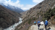
Starting in the rustic east of Nepal, homeland of the Rais and other \'middle-hill\' Nepalis, we begin our journey from Tumlingtar, landing on a grass runway! We trek along the turquoise Arun River, through the green, terraced hills of the Arun and Salpa Valleys to Solu, and continue cresting and descending large hills, passing through thatched Rai and Sherpa villages, heading towards Lukla and the old Tibetan trading center of Namche Bazaar.
| Max. Elevation : 4800m | Grade : Strenuous |
| Best season : Sept-Dec & Feb-May | Type of trek : Camping/Teahouse |
| Duration : 27 Days | Starting point : Kathmandu |
| Ending point : Kathmandu | Highlights : Culture/Nature |
The Arun Salpa valley trek is one of the most scenic and challenging treks in Nepal. Many early Everest climbers used this hilly and diverse route to get to the base of Mt. Everest from where they made the summit bid.
Starting in the rustic east of Nepal, homeland of the Rais and other 'middle-hill' Nepalis, we begin our journey from Tumlingtar, landing on a grass runway! We trek along the turquoise Arun River, through the green, terraced hills of the Arun and Salpa Valleys to Solu, and continue cresting and descending large hills, passing through thatched Rai and Sherpa villages, heading towards Lukla and the old Tibetan trading center of Namche Bazaar.
The Arun Valley is a region which sees few trekkers, so the trek will be a real adventure and a look into the timeless mountain villages and cultures of Nepal.
Once at Lukla and the Khumbu region, the festival of peaks begins; heading north towards Cho Oyu and the border of Tibet, the 8000 meter giants tower above us as we trek through Sherpa villages. While exploring the stunning, turquoise Gokyo lakes and climbing Gokyo Ri, and trekking the spectacular eastern trail we retrace our step back to the old Sherpa villages of Phortse and Pangboche, taking time to stop at the many gompas (monasteries) including the well-known Tengboche Gompa, and visiting old Sherpa villages before finally arriving to Lukla from where we board a flight back to Kathmandu.
Outline Itinerary
Day 01: Kathmandu arrival (1340m)
Day 02: Kathmandu
Day 03: Fly Tumlingtar (487m)
Day 04: Trek Kartiki Ghat (315m)
Day 05: Trek Gothe Bazaar (685m)
Day 06: Trek Salpa Phedi (1520m)
Day 07: Trek to Jau Bari (2000m)
Day 08: Trek Gurase (Chayaksila- 3000m)
Day 09: Trek Tiu (2670m)
Day 10: Trek Gudel (1965m)
Day 11: Trek Kiraunle Gompa (2540m)
Day 12: Trek to Sibuje (2660m)
Day 13: Trek to Pangum (2900m)
Day 14: Trek to Phakepani (2775m)
Day 15: Trek to Monjo (2840m)
Day 16: Trek to Namche (3450m)
Day 17: Namche
Day 18: Mong La (4000m)
Day 19: Trek Machermo (4430m)
Day 20: Trek to Gokyo (4800m)
Day 21: Gokyo
Day 22: Trek Phortse (3780m)
Day 23: Trek to Namche
Day 24: Trek Lukla (2845m)
Day 25: Fly to Kathmandu
Day 26: Kathmandu
Day 27: Final departure
Detailed Itinerary
Note: Although we try to follow the itinerary below, at times local trail or weather conditions or lodge accommodation may make slight changes necessary. The trekking itinerary may also vary slightly depending on our trekkers' acclimatization rates.
Day 01: Arrive Kathmandu International Airport- T I A (1340m) and transfer to hotel.
Day 02: A free day to explore the Kathmandu valley. Options: Climb the many steps to Swayambhunath (the monkey temple), with its commanding views of Kathmandu (at 1420 m), its whitewashed stupas and its unique synthesis of Buddhism and Hinduism. The striking Buddha eyes of Boudhanath Stupa watch over a lively and colorful Tibetan community and attract pilgrims from all over the Himalayan Buddhist realm. In the midst of traditional gompas, and hung with long strings of multi-colored prayer flags, Boudhanath attracts Sherpas, Tibetans and tourists alike for daily circumambulations (koras) of the stupa. Durbar Square, one of the old capitals of the Kathmandu valley, is a synthesis of Hindu and Buddhist temples, stupas and statues, and is often the site of festivals, marriages and other ceremonies. Hindu Pashupatinath and its sacred temple complex on the banks of the holy Bagmati River. Here, monkeys run up and down the steps of the burning ghats, and trident-bearing saddhus draped in burnt-orange and saffron sit serenely meditating - when they’re not posing for photos-for-rupees.
In the late afternoon, we should have sometime for a bit of gear shopping in Thamel for anyone who needs to do this, and in the evening we will head out for welcome dinner hosted by Makalu Adventure with live Nepalese culture shows.
Day 03: Fly to Tumlingtar (487m):
We'll head to the airport after breakfast for our flight to Tumlingtar in eastern Nepal, the starting point of our trek through the Arun Valley. It's a beautiful flight over terraced fields and traditional villages with a range of Himalayan 8000 meter peaks peeking over the haze in the distance. The landing is classic old-style Nepal; a sharp turn, a steep descent to a grassy runway.
We'll set up camp just above the airfield; introduce you to the rest of the Makalu Adventure crew before having lunch. After lunch you'll have the afternoon free to reorganize yourselves and explore the rustic village of Tumlingtar. The next few nights will be warm, so dinner will just be in a t-shirt; enjoy it while it lasts, and have a cold beer to wash it down as we're sleeping at 400 meters.
Day 04: Trek to Kartiki Ghat (315m):
The Arun Salpa Valley trek will be wonderful days of 'old-style' trekking through the idyllic middle hills of eastern Nepal, a very diverse region of many ethnic groups, shamanistic religion interspersed with Buddhism and Hinduism, traditional villages, green, terraced fields, small, riverside trails and basic accommodation.
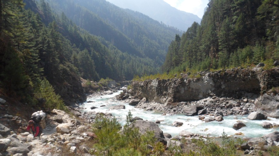
With the mountains rising in the hazy distance, Chamalang to the left and Makalu to the far-right, we set out with our crew from our campsite at Tumlingtar, following the small road through the long village and adjoining series of small, lively villages and colorful tea-houses; there will be many locals sharing the trail with us, as well as trains of mules carrying cardamom, the biggest cash crop in the region. After an hour, we reach a fantastic suspension bridge with side ties stretching across the wide Arun River (which we don't cross) and drop down to the sandy riverside, peppered with rounded beach rocks. Following the river closely, we pass terraced rice fields, buffalos, thatched huts and villagers working in the fields. Soon, the Chewa Besi primary school appears on the right, a scenic spot under banana trees, followed soon afterwards by the small, local tea-houses of Chewa Besi where we stop for a packed lunch.
After a game of 'karam board' at the tea-house, we continue to Kartiki Ghat, where we cross the Arun river on a long suspension bridge. The main village, known for its bees and honey, stretches out just past the bridge, and our campsite is not far past the village, a scenic, green campsite right on the Arun River, between two gurgling streams. Enjoy the warmth of this 'tropical' site, and pick up some cold beers from town.
Day 05: Trek to Gothe Bazaar (685m):
We start the morning with an easy twenty minute walk to the lovely village of Balwa Besi, where we cross a small, sparkling stream on a wooden bridge and then start climbing through a lush, tropical forest of cardamom, banana and papaya trees, and past thatched huts to a chautara (local rest-spot, here also a spectacular viewpoint) high above the hazy valley and the Arun River. Leaving the lovely Arun behind, we have 600 meters to climb before lunch, and the trail of red mud can be slippery if the weather has been damp. Contouring around hillsides and continuing to climb, we reach Marduwa, a small hamlet where we'll stop for a cup of tea. We soon pass more terraced fields and clusters of ochre and cream mud-brick houses built in the local style, eventually stopping for lunch near Nepali Danda, also called Charlissay, named after a Chettri caste that lived here many years ago, and have not reputedly migrated to the Kathmandu area. Soon we reach the intersection of the old trail from Dingla, and after contouring around a hillside we reach a larger trail near a cluster of banyan trees. The forest thickens again as we ascend and then drop back down to the Irkhuwa River, crossing two bridges, the second one a long suspension bridge, and following a riverside trail for another hour or so to Gothe Bazaar, the inhabitants a mix of Gurung and Rai. At Gothe Bazaar, the local woman will have bunches of sweet bananas and tangerines for sale at the first section of the village, and at our lovely campsite a few minute down the trail, we should be able to find some local pumpkins for soup. Keep your eyes out for brilliant, blue Kingfishers looking for fish in the river.
Day 06: Trek to Salpa Phedi (1520m):
Another balmy but early start as we head towards Lankuwa village and then further on to Dhobani, a village of paper-makers (the same that you see in the Kathmandu markets) en route to Salpa Phedi.
We leave Goethe Bazaar by crossing the stream, and soon pass many thatched huts, some for buffalos and others simple dwellings. Delicious tangerines are sold along the trail again by local villagers so don't miss the chance to pick up a bunch for the day. We cross the river on a flexing bamboo bridge, and trek through several small, picturesque whitewashed villages with thatched roofs and ochre bases. We pass through Lankuwa village and then start on a steep, uphill climb to Dhobani; along the way, keep an eye out for the traditional fishermen with their long, bamboo nets. We continue through a thick, tropical forest of cardamom and other large-leaf trees, climb the 'waterfall steps' and eventually reach Tala (Lower) Phedi, where they also make paper. We'll stop for a cup of tea at the small teahouse before hiking another hour uphill, on a lovely hill-side trail backed by undulating grasses, rocks and fruit trees until we reach the grassy campsite, a welcome site. Someone will undoubtedly be around with a basket of expensive but much needed beers and cokes.
Day 07: Trek to Jau Bari (2000m)
We shortened this day to avoid a 1500 meter ascent in one day, but if people are fit we can do it all the same day. We did this the past two years but it's a bit daunting. If we divide the day in two, we'll hike three hour very steeply up to Jau Bari and camp on the grassy campsite of the Sherpa Lodge. The day below assumes we've started from Salpa Phedi.
Day 08: Trek to Gurase (Chayaksila - 3000m):
We start the morning with a steep climb on stone steps, passing through the many dwellings of upper Salpa Phedi, and then keep climbing with increasingly amazing views down the valley, the layers of hills various shades of icy-blue below us. It will take us several hours of climbing to reach Jau Bari, a village where they grow the best barley in the region and where there is a Sherpa gompa (monastery) just below a lovely Sherpa-run campsite. We'll stop for a breather here, and then continue past the terraced fields and then through rhododendron forests, increasingly thick, past the turnoff to Salpa Lake just past the small 'Gurase La', to Gurase or Chayaksila, a local porter stop with several Sherpa houses which translates as 'best rhododendrons'. We set up camp in back of one of these houses, on one of the only flat plateaus in sight, and are treated to a breath-taking sunset and sunrise. It will be colder here, so you'll want your down jacket for the evening.
Day 09: Trek to Tiu (2670m):
Onto the pass! The Salpa Bhanjyang, 3360 meters, with its single chorten, is the border of Solu Khumbu and the Sherpa region. It's a short ascent, just over an hour, to the chorten-topped and windy pass where we have wonderful views of snow-capped Karylung Peak. We descend steeply through the forest, following a small stream and several Mani walls, to the Lidung Khola, where we cross to the north bank and continue on to Whaka with its few local tea-houses. An hour or so afterwards we reach the picturesque Sherpa village of Sanam our stopping point for the day. Sanam, 'the land of the sky', is a lovely village with traditional Sherpa houses and terraced fields, which we look down upon from our grassy campsite. Fresh yogurt is sometimes available, so we'll take a look around the village for some. From Sanam it's an easy half an hour further to camp at Tiu, where we set up camp in a grassy site and get ready for a few beers in the evening. We'll have the afternoon free, enough time to explore the village or do some much-needed washing up!
Day 09: Trek to Gudel (1965m):
Leaving pleasant Tiu, we contour along a high trail with broad views, and soon arrive at the rustic gompa at Nimtsola village with its new Guru Rimpoche statue; past this village, Sherpa influence ends and the land of the Rai begins. The Rais, who speak an ancient, non-written language called Kiranti, were some of the earliest hill-inhabitants of the Nepal middle hills, a stout, attractive and proud ethnic group which you will see all over the Everest region, and winning most of the high-altitude races. The trail is now larger as we contour another few hours along the hillside, passing a local paper 'factory' en route, and finally reaching the many buffalo huts and terraces fields of the large Rai village of Gudel Phedi. The equally sprawling village of Bung and the Naulekh Mountains are visible in the distance, as is Mera Peak to the far right as we enter the village. Just over the ridge, we descend steeply on slate steps to our campsite in back of Namaste Lodge at Gudel.
Gudel is a very interesting, picturesque and traditional village of Kulung Rai, with approximately five hundred houses and a large school partially funded by an Australian INGO with 650 students. We have scheduled a long afternoon here to explore and take photos of the colorful dwellings and chat with the welcoming villagers. The Rais grow a diverse variety of crops, which include wheat, corn, potatoes, barley, millet and 'sag', a local spinach-like green. You'll see the corn, actually maize, drying from racks above the ground, wicker baskets stacked on the decks and pigs, chickens and roosters freely roaming the village. The village is also reported to grow the most delicious taro in the region, so we'll search out some for dinner.
Day 11 - Kiraunle Gompa (2540m):
We'll start early as it's a long day, beginning with a steep, six hundred meter descent through rice paddies and cardamom plants, on slippery stone slabs, to the bridge over the river far below us (1325m). We cross a long, wooden bridge and begin the equally steep ascent to the large, Rai village of Bung. Following the stream on a rock trail, we ascend a switch-backing trail after crossing the Hungu Khola; Bung begins soon afterwards and continues upwards, built on the hillside, the lowest houses of the village about three hundred meters below the upper reaches. Bung means 'beautiful flower' in Rai, and is indeed a lovely, bustling village renowned for its tongba, or millet beer. It has received much development aid recently as partly because so many of the Rai men from Bung are trekking porters, guides or cook at the lodges in the Khumbu. Villagers will be selling oranges at the start of the village, and half way up there is a big school. We usually trek up to the school with the kids, who seem always to be late for the morning exercises and skip up the steep, stone steps. A few minutes above the school are several shops where you can pick up a coke, snack or possibly oranges. The entrance to the Makalu Barun National Park is just across the trail. We keep climbing, eventually the trail flattens a bit, and we continue to trek with great views and cooler temperatures until we reach a small cluster of houses and a grassy plateau where we'll stop for lunch. Soon afterwards, there is a small, friendly tea-house where we might stop for a glass of tea and give the owner some business. Just afterwards is the local school of Kiraunle, with the green, Sherpa village of Kiraunle to the right, and a last steep climb on stone steps brings us to the grounds of Kiraunle-Chambaling Gompa, recently built, our campsite for the night. There is no permanent monk or lama in the gompa, but you can walk the mani-lined perimeter and take a look around inside the gompa walls.
If the porters arrive late, wander into the cozy kitchen of the Kiraunle Lodge, where the friendly owner might be brewing a pot of salt-butter tea. The temperature begins to cool down as we ascend, and the clouds often move in during the afternoons. Be ready for a chilly morning as well!
Starting from the small airport in Tumlingtar at 487m altitude, and climbing all Himalayas vegetation with a rewarding perspective towards 5 of the 6 highest mountains of the planet, from left to right: Cho Oyu, Everest, Lhotse, Makalu, Kangchenjunga as the journey continues with parts of Everest trek on Khumbu valley.
Day 12: Trek to Sibuje (2660m)
Another pass day, this time a two and a half to three hour hike up to the crest of the Surkie La. Heading straight up out of the campsite to the ancient, moss-covered chortens and mani walls on the ridge, we pass through an ancient rhododendron forest dripping with Spanish moss. After nearly two hours of hiking we reach the Kulung Rai hamlet of Charakot, really just a small group of tea-houses and a grazing 'ghot'. Soon afterwards past another few tea-houses and more Mani walls we reach the Surkie La (3070 m). There are better views at the sightseeing platform just above the narrow 'pass' ridge where we'll be able to see Karyolung, Khatang and Numbur, so head up for a look. The descent is steep, down a rocky trail and through a forest of bamboo, and soon we arrive at the scenic grazing area of Najing Dingma, a tiny hamlet and grazing area with a few small tea-houses and shops, set on a flat, green section of the hillside.
We leave Najing Dingma and descend through a leafy woods for an hour to Gai Kharka (a kharka is a seasonal grazing settlement in Nepali, and gai means cow), another small village of only a few thatched huts, and continue descending steeply to the rickety bridge (built by the Himalayan Trust, obviously many years ago) high above the Inkhu Khola. From here, we've got a steep ascent of which the owner of the small Nepali tea-house near the bridge said 'it's so steep that even the monkeys fall off'. Enough said, it's a steep climb of two to three hours to the next village, but as we gain altitude we're treated to spectacular views up and down the Inkhu Valley, eventually spotting Mera Peak looming in front of us. Shubuche (pronounced Sibuche; the local Sherpa name is Ningso, which means dense bamboo forest) is a large village at 2660 meters, spread out over the hillside, market by Tibetan prayer flags at the lower end, with two local tea-houses just past the flag and a small gompa at the upper reaches. We'll be happy to reach our campsite in lower Shubuche, a lovely, a grassy plateau carved out from the hillside, in back of which a friendly is Sherpa lodge. Tongba sometimes available.
Day 13: Trek to Pangum (2900m):
After breakfast, we'll only have an hour of climbing to reach the two small tea-houses below the pass, and then another hour to reach the Pangum La (or Satu La) pass, at 3175 meters. We see the trail from Jiri, the Trakshindo La and the incredibly scenic Sherpa village of Pangum below, and in half an hour reach our scenic campsite in back of a friendly Sherpa lodge. Pangum now has a few quite nice lodges, a Hillary school, fields marked by wooden fences and a Tibetan Buddhist gompa off to the northern side of the village. We'll have a fantastic sunset out over the wide open valley, with Karyolung rising majestically in front of us, across the Dudh Kosi (the 'milk river' that leads to the Khumbu region).
Day 14: Trek to Phakepani (2775m):
The camping has been great, but we'll welcome the next few nights in cozy Sherpa lodges from now on. Heading out of town past the long rows of old mani walls, we look out at the hilltop villages of Bupsa and Kharikhola in the distance, but veer right on a smaller, wooded trail towards the small hamlet of Kharte two and a half hours away and then the Khari La ('wide pass'). Once fortified with a cup of tea at Kharte, it will take us a good hour and a half of contouring and climbing to crest the pass at 3075m meters, but the views are amazing from the top. We'll have our first view of the sacred Sherpa peak, Khumbu Yul Lha (Khumbila), and Gyachen Kang, and then Kusum Kangaru just around the corner. It's a quick descent on a rocky trail to the main Jiri trail, and then just another half an hour to the charming village of Puiyan, where we'll stop for lunch. Another enjoyable hour of hiking along a wide trail with broad views and over a small ridge brings us to Phakepani, where we stay overnight. Showers, cold beer and tongba are available, so clean up and head to the warm kitchen table for the evening.
Day 15: Trek to Monjo (2840m):
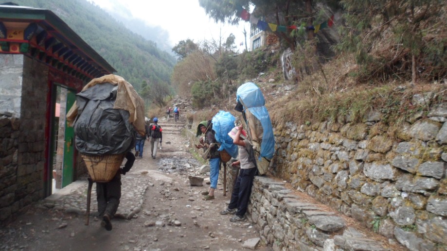
After a good night's sleep and a lodge-cooked breakfast, we head through the long village of Puiyan, past the lively school, and stay relatively level for a few hours. Getting closer to the upper Khumbu region, we continue to contour around hillsides, just below a small pass called Chutok La to another small hamlet of Surkhe from where we have a glimpse of the Kongde Massif (Nupla peak) and across (up) the valley, Lukla. After crossing a suspension bridge, a gradual incline and gentle series of cobbled steps leads us below Lukla to Chaunrikharka, where we amble along an old, walled trail pass many traditional Sherpa houses, mani walls and fields of barley, potatoes and vegetables, a dramatic entrance to the Upper Khumbu region. We continue through this magical village pasts more Mani walls until we reach Chheplung, a village of checkered fields and a few small lodges.
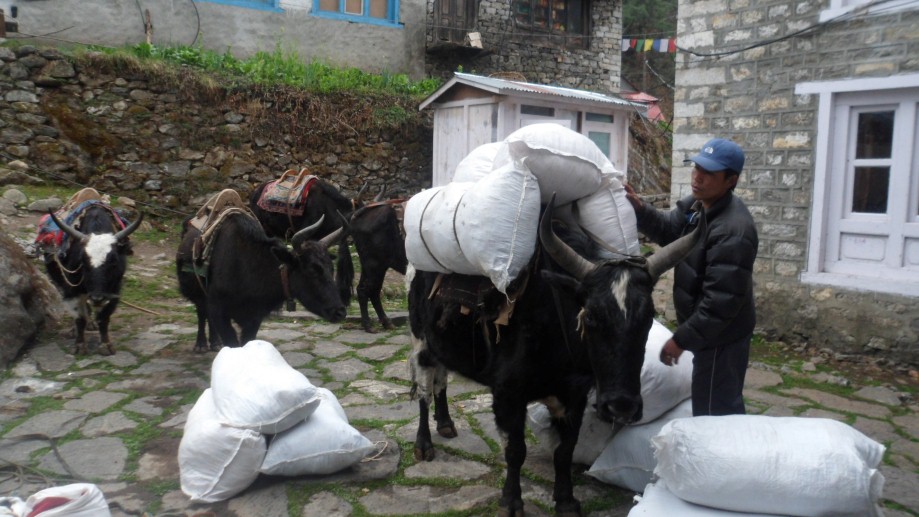
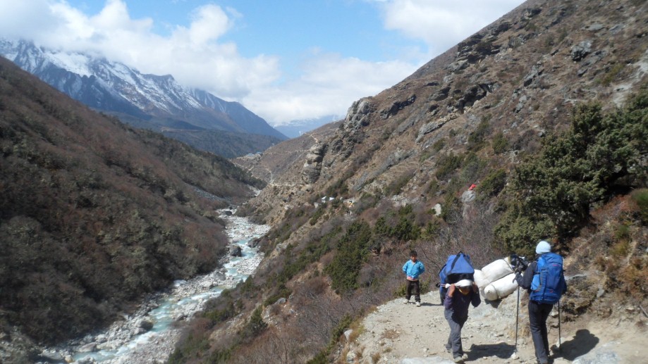
From here, the mountain views keep getting more and more spectacular as we head north towards the turquoise Gokyo Lakes. Ahead of us is Karyolung peak, covered in snow. We are trekking along the Dudh Kosi (river) along a centuries-old trading trail from Nepal to Tibet. It is well traveled by stout, heavily loaded Nepali porters and Tibetan traders (Khampas, most distinguishable by the length of red or black tassel wrapped around their heads) conducting business between the weekly markets of Lukla and Namche with Chinese and Tibetan goods brought over the 5700m Nangpa La (pass) from Tibet.
From the small hamlet of Thado Kosi, while crossing a small, shaky bridge, we view the three sister peaks of Kusum Kanagaru to the east. More beautiful walking over cobbled trails takes us through Ghat and the best-maintained cluster of Mani stones and prayer flags in the Khumbu. The local lama, owner of the Lama Lodge in Ghat, is responsible for this magical setting. At Phakding, a lively village a half hour's walk away from Ghat, we’ll have lunch and some rest before proceeding further towards Monju.
Passing by the small tea-houses servicing the locals and workers in Phakding, we cross a long suspension bridge over the Dudh Kosi and trek above the river, climbing a bit to reach the first lodge of Benkar on the left. Continuing over a small bridge, we continue through the rest of Benkar, the first village to attend the Monjo School. Another suspension bridge, another climb, and we reach Chumoa. One more small bridge and larger climb on uneven stone steps, and we finally reach Monjo, where we stop for the night. Overnight at hotel.
Day 16: Trek to Namche (3450m):
Passing by the small tea-houses servicing the locals and workers in Phakding, we cross a long suspension bridge over the Dudh Koshi and trek above the river, climbing a bit to reach the first lodge of Benkar on the left. Continuing over a small bridge, we continue through the rest of Benkar, the first village to attend the Monjo School. Another suspension bridge, another climb, and we reach Chumoa.
Just past the lodge, school and newly painted Mani walls we enter the gateway to the Sagarmatha National Park. Once inside the new gate, we descend to the river and cross yet another suspension bridge to reach Jorsale village, and one more bridge before continuing along the sandy riverside trail, the shores peppered with large, rounded rocks.
Bring your five-colored Tibetan prayer flags to hang on the long suspension bridge over the confluence of the Dudh Kosi (Milk River) and the Bhote Kosi (river from Tibet) and send prayers out into the Everest region! The steep hour and a half climb to Namche is broken half-way up the hill by our first view of Everest, Lhotse & Nuptse, and will prime you for the bakery once we arrive at this old trading village.
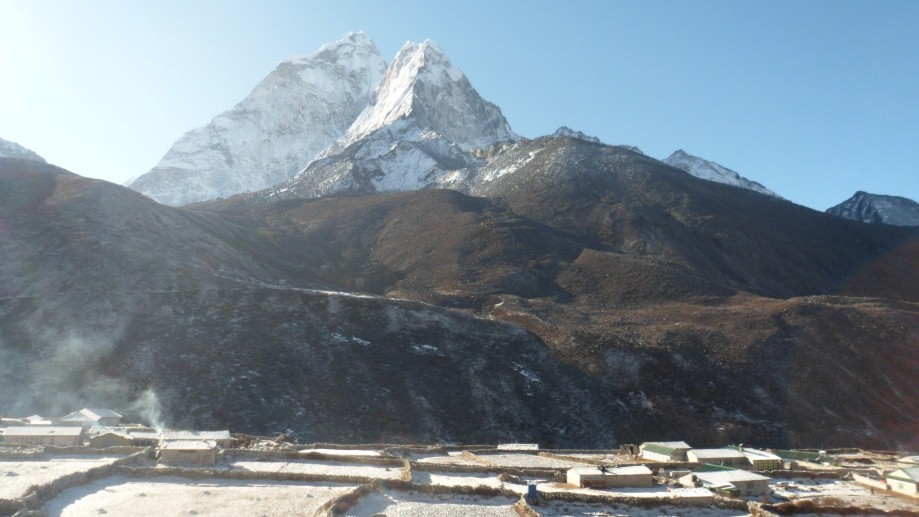
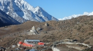
Namche Bazaar, now the most prosperous trading village on the old trade route with Tibet, sits in an amphitheater surrounded by mountains. From here, we have perfect views of Kongde Ri in front of us, Kantaiega, Thamserku and Kusum Kangguru to the east and Khumbila behind us. Down-valley, the hills and valleys of the route from Solu to Khumbu from Jiri sit shrouded in hazy shades of grey.
Day 17: Namche rest and acclimatization:
An acclimatization day in Namche. Everyone is free to relax and explore the bazaars, the bakeries, the Sherpa and National park museums, Namche Gompa and the Tibetan markets. If it happens to be Saturday, then it’s an open market day here and we will take the morning to explore the bustling market, a feast of colors, smells (not all of them appealing), and colorfully-clad Sherpa women up from their villages for the weekly event. It’s as much a social gathering as a produce, meat and essential goods market, so the atmosphere is spirited and lively.
• Day hike option to Khunde (4000m) and Khumjung(3790m):
As today is an acclimatization day, everyone will be free to do as she / he wishes. One can either just have a full day of rest doing nothing but staying in the hotel or shopping around or alternatively if one prefers for a short hike (much better for acclimatization) we can then hike to Khunde and Khumjung valley.
Taking advantage of the crisp morning light we'll hike up the steep hill in back of Namche towards the lively, old Sherpa villages of Khunde and Khumjung, passing through the old airstrip at Syangboche, still used for cargo, en route. On the ridge above the airstrip we climb to a large, whitewashed chorten at the yak-breeding center. From there, we have are fabulous views of Taboche, Ama Dablam, Thamserku, Kantega, Kusum Kanguru, Everest, Lhotse and Nuptse. We may see some Himalayan Tahr grazing on the hillsides, and possibly Danphe and Chukkars.
We will visit the Khumjung Gompa, home to the only existing Yeti scalp on the planet. The adjoining villages of Khumjung and Khunde are some of the original villages in the Khumbu region, both about 600 years old, and are wonderful examples of local Sherpa architecture with their winding stone walls, yak paddocks and wood and slate houses.. Both villages sit below Khumbila, the sacred Sherpa peak, and near a famous rock-mural of Guru Rimpoche. The views of Ama Dablam from this valley are breathtaking. Heading up the valley just a bit, we will visit Khunde's hospital, after that we head back to Namche, have dinner and retire.
• Other options
Visit the Namche Gompa perched on the hillside, the Sherpa Cultural Center museum and re-constructed Sherpa house or the National Park Headquarters museum. The Tibetans are often in the center of town in a dusty bazaar with their goods from China. Alternatively, you might choose just to indulge yourself at one of the two famous bakeries, shop for some yak bells or hand-woven Himalayan hats, look through the gear shops for good trekking gear, chat with the sociable Sherpas in the village, or just relax in preparation for the trek. Watch out for dzobkios and cows wandering the narrow streets. For some peak-spotting, climb steeply to a viewpoint an hour’s walk straight up the ridge, worth the effort for the panoramic views of Everest, Lhotse and Ama Dablam. Along the way, you are likely to see some wildlife such as musk deer, himalayan tahr and the spectacularly-hued danphe (the Nepali national bird).
From Namche upwards, the acclimatization process dictates our itinerary, so we will have plenty of shorter days walking.
Day 18: Trek to Mong La (4000m)
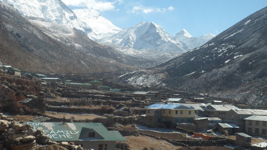
Leaving Namche, we trek along the wide trail heading north and contouring around several ridges, past the large, white chorten where we'll be treated to fantastic views of Everest, Lhotse and Ama Dablam rising high above the Dudh Kosi. About two hours later we reach Tashi & Lhakpa's Ama Dablam Lodge in Kyangjuma, perched dramatically on a steep hillside overlooking the peak of the same name. Continuing along the main trail, we veer left at the intersection to Gokyo and take the steep trail up to the bridge which intersects with the old trail from Khumjung, and climb gradually for another hour or so to Mong La, where we will have lunch on the deck of our lodge perched spectacularly on this 4000 meter ridge. We're stopping here for the night, a perfect acclimatization point and a wonderful spot overlooking both the Gokyo and Kala Pattar valleys, with a breath-taking panorama of peaks: Ama Dablam, Thamserku, Malan Palan, Tarboche and the newly named Kamzang Peak. Phortse, one of the oldest villages in the Everest region, is perched at the intersection of the Khumbu & Gokyo valleys in front of us. The misty layers of the hills and valleys south of us are visible down-valley, as are Monjo and the bridge to Jorsale. Walk out on the ridge and look down on Tengboche Gompa on the ridge across the Dudh Kosi, and enjoy a 'local' evening.
Day 19: Trek to Macherma (4430m):
After a scenic breakfast, we descend steeply through the pine forest to Phortse Tenga by the river, immediately ascending again. The route is beautiful, past frozen waterfalls, up cathedral-like stone staircases, through old rhododendron and Himalayan Birch forests, across small rivers and past tiny Sherpa settlements. The forest is home to several musk deer, shy creatures who peer out at us through the tangle of rhododendron. We arrive a few hours later, having had our first view of the 8000 meter Cho Oyu, at the summer herding settlement of Dole, where we can stop for a cup of tea. Dole translates as 'plenty of stones’ and anyone who has extra energy can cross the stony streambed and ascend either of the neighboring ridges for some good Himalayan views.
We continue up the Gokyo valley, gaining elevation, along a trail high above the valley floor, Cho Oyu looming in front of us at the border of Nepal and Tibet for the later part of the walk. We pass some small Sherpa herding huts en route, and after a few more hours of trekking we arrive at the charming yak-herding settlement of Luza. This is one of the many seasonal settlements of the Khunde and Khumjung inhabitants; the next one is Macherma, which we reach 45 minutes later, having climbed steeply out of Dole to a set of prayer flags marking the end of the settlement, and ascending and descended once again to Macherma. Anyone wanting an afternoon hike can climb up the ridges on either side of Macherma.
Day 20: Trek to Gokyo (4800m):
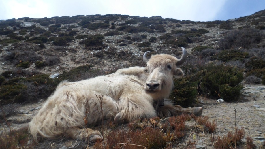
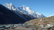
Another beautiful and mountainous trekking day; we set off early as the walk up to 4800 meters is more difficult than usual at altitude. In the Gokyo valley, once past the lodge at Fanga, the character of the trekking changes abruptly. The opaque powder-blue lakes are often on the verge of freezing over, and sometimes perform a Himalayan symphony of expanding and retracting ice. We have entered the grassy ablation valley running beside the Ngozumpa Glacier, and have our first sight of Gokyo, a seasonal village and grazing area built beside the third and biggest lake. Gokyo has become something of a Himalayan resort without the crowd – at least in terms of the comfortable lodges with sunrooms, unbeatable views, excellent food and warm stoves. A more spectacular setting is difficult to imagine, and lured into the wonderful sun-room, it is easy to spend the rest of the day chatting with fellow trekkers, watching shaggy yaks amble their way in and around Gokyo (sometimes casually sticking their heads inside the lodges) and admiring the lake-side views.
Wander along the lateral moraine overlooking the Khumbu glacier for sunset, just a ten minute walk above Gokyo...
Day 21: Gokyo
After breakfast we'll cross the small, glacial stream, jumping over the stone 'bridge' to get to the base of Gokyo Ri (5360m), just five minutes from the lodge. It will take us about two hours of switch-backing to reach the prayer-flag festooned summit; take your time as the views down valley past Gokyo lake are great the whole way up. From the top, we are treated to a spectacular, 360 degree panorama of the Gokyo lakes, the glacial moraine and the surrounding Himalayan giants; Cho Oyu, Everest, Lhotse and Makalu among many others. To the west is the Renjo La (4515 meters) pass, the gateway to the Thame Valley and the Nangpa La, which the Tibetans cross with their yaks en route to Namche.
For those with extra energy, a nice afternoon excursion is a circumambulation of Gokyo Lake; there is a beach at the other side, and then Buddhist and Hindu shrines just past that, a walk of 1 to 1 1/2 hours. And for sunset, don't miss a quick hike up the moraine ridge in back of the village for glorious sunset colors on Cho Oyu, turning pinker down valley towards Cholatse, Tarboche and Thamserku.
If we've climbed Gokyo Ri on our first day at Gokyo, an option for today is a scenic day hike up the Gokyo valley, past two or three more glacial lakes, towards Cho Oyu. There are several trails that snake up this gorgeous valley, one emerging on the ridge overlooking the creaking glacier, another passing the eerily deserted fourth lake with its white, stony beach. The unobstructed view of Everest from Scoundrel's Point (4995m), just before the fifth lake, is reason enough for the hike.
Day 22: Trek to Phortse (3780m):
A truly epic day of wonderful hiking on High Mountain trails which skirt the ridges on the west of the river. We trek back along the lakes to just below the stone steps, where we cross the river to the small hamlet of Na, and then gradually climb back up, contouring on a high trail along the western side of Cholatse and Tarboche peaks. Looking back, we have an unobstructed view of Cho Oyu and the glacial valley, and ahead Ama Dablam. There are several lovely villages, yaks in the walled enclosures, for tea and/or lunch (although perhaps with limited options in December), other scenic, stony seasonal villages, a few ridges topped with chortens to climb, magnificent views of Tarboche, and lots of wildlife, so enjoy the day.
We arrive early afternoon at Phortse, in time to stop at the colorful Phortse Gompa at the very top of the village. Phortse, a maze of small, walled lanes, traditional houses and now many newer lodges, is one of the oldest villages in the Khumbu. The village perches scenically on the promontory protruding from Tarboche, which towers majestically above it. Many Daphne, musk deer and blood pheasants live in the woods that border the village, and you can almost always see them early and late in the day. Overnight at lodge.
Day 23: Trek to Namche
A wonderful walk along well-used yak trails down to the bridge over the Dudh Kosi, through rhododendrons and past ancient, moss-covered Mani walls to Debouche, where we'll stop at the ani gompa, or nunnery. Afterwards, we start the steep climb to the spectacularly set Tengboche Gompa, backed by the massive wall of Kantaiega. We'll stop to visit the gompa, have some tea, and descend steeply to Phunki Tenga and the bridge across the river. A last steep climb and some contouring through scrub, pine forests and rhododendron eventually leads us to Kyangjuma, where we stop again for a sunny lunch. A further 1 1/2 hours of contouring brings us to the top of Namche Bazaar. Overnight at lodge.
Day 24: Trek to Lukla (2845m):
Up early as it's quite a long day back to Lukla. The descent of that long hill that we plodded up less then a fortnight ago seems amazingly short and easy on the way down. After one last steep hill to the National Park gate, we reach the welcome sight of Monjo, where we'll stop for some tea. We continue back to Lukla along the same trail, although it always looks different coming from the opposite direction. We’ll stop for lunch in Phakding, and finish the trek back in Lukla. We join the dancing and drinking party in the evening with rest of the crew and bid farewell to them as they would be heading into different direction while we board on a flight to Kathmandu the next morning.
Day 25: Fly to Kathmandu:
Bags packed and ready to go early as we fly out of Lukla to Kathmandu in the morning; taking off from the Hillary Airstrip is just as exciting as landing! Flights out of Lukla are sometimes delayed by bad weather, so we have an extra day in Kathmandu just in case.
Back in Kathmandu hot showers await, and grubby clothes can be dropped at the laundry. In the evening, we'll get together for the best wood-oven pizza in town at Fire & Ice, followed later by coffee and drinks later at one of Thamel's many cafes.
Day 26: Kathmandu
A free day in Kathmandu for shopping or alternatively visiting sights we missed during the first few days in Kathmandu, we can catch today, and afterwards out for farewell dinner in the evening. This is also the extra day in case of delayed flights out of Lukla
Day 27: Final departure
Extra Days in Kathmandu
If you wish to stay longer, we can offer plenty of suggestions: mountain biking or rafting in the Kathmandu valley, an Everest sightseeing flight, trips to Bhaktapur or Patan (Kathmandu Valley's other historic capital cities), a night at the Fort Hotel in Nagarkot for a bit of luxury and expansive sunrise/sunset mountain panoramas, visits to interesting temple villages such as Changu Narayan, a few days at Barahi Hotel in Pokhara or a relaxing excursion to Chitwan National Park or Bardia National Park.

- All ground transfer by private vehicles as per our itinerary
- Fine hotel –Thamel Eco Resort in Kathmandu (twin sharing including B/F and taxes)
- Welcome dinner with live Nepalese cultural program hosted by Makalu Adventure
- Guided sightseeing around Kathmandu world heritage sites including all entrance fees
- All domestic airfares (Kathmandu-Tumlingtar- Lukla - Kathmandu)
- Organized camping trek arrangements including all high quality German Salewa / UK Super Quasar camping equipment such as two men tent, kitchen tent, dining tent, toilet tent, tables, chairs, mattresses, hot water bags, pillows, inner sheets etc.
- Everyday three times hot meals while on trekking prepared by our professional kitchen crew during the camping and all meals from lodge menu while staying at lodge or teahouse.
- National park, conservation area permit and fees wherever applicable
- Guide, porters, their daily wages, insurances with all necessary lodging / fooding arrangements.
- Administration service during rescue and evacuation (if required)
- Down jacket, sleeping bags, Trekking kit bag/duffel bag, trekking map and trekking Poles
- A comprehensive medical kit
- All government and local taxes
- Nepal visa fee.
- Airport taxes.
- International airfare to and from Kathmandu.
- Excess baggage charges.
- Lunch and evening meals in Kathmandu.
- Extra night accommodation.
- Travel and rescue insurance.
- Personal expenses (phone calls, laundry, bar bills, battery recharge, extra porters, bottle or boiled water, showers etc).
- Rescue and evacuation if required.
- Tips and gratitude